|
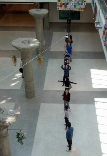
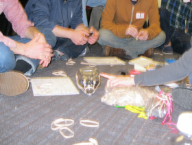
Balloons are often used as metaphor... But what about putting them to use as a tool for gathering information? I love maps and balloons are pretty cool too, so the combination for data collection gets me a bit excited... Is it a match made in geo-heaven? To what situations could this technology be applied? What were the barriers to entry? How good were the results? I had to see for myself. So a Greyhound ride and a Septa token later, I'm standing with 20 other geospatial enthusiasts staring into the sky at a large orange balloon on Philadelphia's Penn's Landing Waterfront. As we all watched, a volunteer walked the balloon along the waterfront and collected data as she went, the camera clicking every 2 seconds. The group patiently listened to stories of balloon mapping, but the real interest was piqued when we prepared a 2nd balloon about 30 min later. That's when I got a closer look at the rig: it consisted of a large spool of kite string, a carabiner, a large balloon (filled with helium), a juice bottle lid and pieces for a 'tail', rubberbands, and a small camera (any will do!). After about 2 hours outside collecting imagery, we reconvened at the Philadelphia School District computer lab to stitch the photos together in Mapknitter and learn how to construct our own camera rigs. We watched a video tutorial on how to import images and piece them together - my first reaction was that imagery post processing requires P A T I E N C E. It also requires a base image to match your tiles which could be a problem in some regions. But, the pros are you control the timing and intervals of the imagery, you do the editing, the data is open and shareable, there is a relatively low cost of entry, and the software is continually seeing improvement. Mapknitter is currently being enhanced to allow for geotagged imagery that will get the editor close, but manual manipulation will still be required. Another option is to use ArcGIS or QGIS to georeference your imagery but is there a good place to upload the imagery once you've finished? What repositories exist? If you have suggestions - please comment! 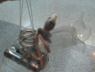 Then the tape, juice bottles, and scissors came out and we got to work on our own rigs. I had brought a camera, so with help, I was able to construct a little rig for it (see left - Hornelius wanted a ride). We then had a trial run in the atrium down a zip line - a great way to get everyone involved! My video was shakey, but that's why we do a dry run, right? Balloon mapping is a fun, non-threatening way to collect data and introduce aerial surveillance to small groups. UAVs are starting to take off as a more controlled way to collect imagery, but the word 'drone' doesn't quite have the same effect as 'balloon'! Verdict? I had a really fun day with a great group of people. I had to miss the follow up happy hour, but I'll definitely be back to visit another time. Thanks Philly ~ You have a great group of people up there and I'd love to host you in Baltimore some time! ****Get your own kit at the Public Laboratory website for $95 - helium not included!****
0 Comments
Leave a Reply. |
ABOUTCombining a passion for travel, the desire to make a difference & a love of maps, MaggieMaps was born. PRESS
Unless otherwise noted, all prose, poetry, maps and photography posted on this blog are Copyright 2013 Maggie Maps
Archives
March 2020
Categories
All
Blogs I like |
 RSS Feed